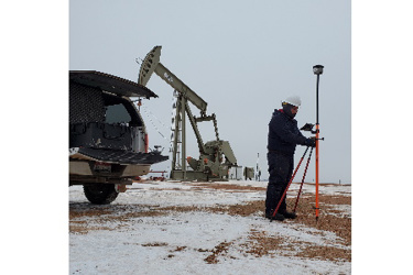
EcoPoint Flowline Mapping Service Offers Operator Compliance, Geospatial Database

Operators of underground oil and gas flowlines in Colorado can fully comply with revised state regulations requiring accurate, universal flowline location data with a field service from EcoPoint Inc., a Colorado-based firm specializing in geospatial data solutions.
As of January 14, 2020, the Colorado Oil and Gas Conservation Commission requires operators to submit GIS mapping data of the full length of both operating and abandoned underground flowlines before the end of the year. The revisions expand on location rules due last year for flowline start and end points
Oil and gas producers can quickly realize operational and asset management benefits with geospatial data management, said EcoPoint CEO, Michael Clancy. Flowline GIS data is easily integrated into an existing database or it can provide the foundation for a valuable, active information system built for growth and accessibility.
“Whether it’s a few feet or several miles, having precise location information can greatly reduce the time spent responding to the next line locate request,” Clancy said. “Our clients report saving up to 70 percent on subsequent line locates.
EcoPoint’s flowline mapping service produces data sets in standard GIS formats and includes completion of COGCC’s flowline compliance Form 44. A mapping database can then expand the operator’s asset management knowledge with a system that is scalable and accessible anywhere on any device.
“Our flowline service is more than just regulatory compliance. It creates a live, interactive and enduring geospatial database that improves efficiency and provides real value to the company,” Clancy said.
Revision of the COGCC flowline regulations (1101-b-3-C) followed passage of legislation known as SB 19-181 last year. It states operators must submit the most accurate GIS data possible for the full length of all off-location flowlines without using invasive methods.
EcoPoint’s flowline service includes flowline data modeling and configuration, onsite line locates, GIS data capture, forms completions and consultations.
Founded in 2017, EcoPoint provides geospatial data gathering and management services for the oil and gas industry in Colorado, Wyoming and North Dakota, and wind energy clients in Texas and Ohio. Underground infrastructure mapping processes are similar for both industries with strong growth expected in oil and gas mapping.
High Point Resources, of Denver, is one of EcoPoint’s first clients and over the past two years, EcoPoint has provided flowline mapping for more than 250 High Point locations. High Point operates in rural areas of the DJ Basin in the Hereford and Northeast Wattenberg fields.
EcoPoint’s custom geospatial database structure and reporting capabilities has been adopted by several other oil and gas companies, including Whiting Petroleum for its North Dakota assets. The familiar user interface allows Whiting staff and contractors to collect and submit mapping data into the system.
For more information, visit https://ecopoint-inc.com
Source: EcoPoint Inc.
